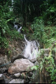
Fall of Water from ‘Roof of the World’

A new report entitled ‘The Fall of Water’ was launched on September 5, 2005 in Nairobi/Bangkok by IUCN and UNEP. It has been compiled and supported by a range of researchers from organisations including UNEP, IUCN, the International Centre for Integrated Mountain Development (ICIMOD), the Chinese Academy of Sciences and the Netherlands Environmental Assessment Agency.
The study is based on a new way of assessing the direct and cumulative impacts of infrastructure development called Global methodology for mapping human impacts on the Biosphere or GLOBIO. It has been developed by UNEP’s GRID Arendal centre in southern Norway, UNEP World Conservation Monitoring Centre in United Kingdom and the Netherlands Environmental Assessment Agency.

The report warns that the mountains of Asia, including the mighty Himalayas, are facing accelerating threats from a rapid rise in roads, settlements, overgrazing and deforestation. There is concern that the region’s water supplies, fed by glaciers and the monsoons and vital for around half the world’s population, may be harmed alongside the area’s abundant and rich wildlife.
The report points to a critical gap in the security of the water to billions of people in Asia and the crucial role of sound environmental management for sustainable development. It claims that unchecked and piecemeal development are likely to increase rates of forest loss triggering increased levels of erosion, pollution and other potentially harmful effects. Conversion of pristine areas into farm and grazing land is aggravating the situation.
By combining a range of local studies with satellite images from 1960 up to today, the scientists have been able to reveal for the first time the scale of land-use changes in the region. Satellite images used in the report reveal that deforestation and unsustainable land use practices may explain why the region’s rivers now have the largest sediment loads in the world and why dissolved nutrients in the water are increasing more than in any other region. This is one of the primary causes for the increasing human drought and flood-related disasters in the region, including the latest floods and resultant high number of casualties in China and India.

The report was released in advance of the 2005 World Summit in New York that took place in mid September. Here heads of state assessed the status of implementation of the Millennium Development Goals including the target of reducing by half the proportion of people without sustainable access to safe drinking water.

A new report entitled ‘The Fall of Water’ was launched on September 5, 2005 in Nairobi/Bangkok by IUCN and UNEP. It has been compiled and supported by a range of researchers from organisations including UNEP, IUCN, the International Centre for Integrated Mountain Development (ICIMOD), the Chinese Academy of Sciences and the Netherlands Environmental Assessment Agency.
The study is based on a new way of assessing the direct and cumulative impacts of infrastructure development called Global methodology for mapping human impacts on the Biosphere or GLOBIO. It has been developed by UNEP’s GRID Arendal centre in southern Norway, UNEP World Conservation Monitoring Centre in United Kingdom and the Netherlands Environmental Assessment Agency.

The report warns that the mountains of Asia, including the mighty Himalayas, are facing accelerating threats from a rapid rise in roads, settlements, overgrazing and deforestation. There is concern that the region’s water supplies, fed by glaciers and the monsoons and vital for around half the world’s population, may be harmed alongside the area’s abundant and rich wildlife.
The report points to a critical gap in the security of the water to billions of people in Asia and the crucial role of sound environmental management for sustainable development. It claims that unchecked and piecemeal development are likely to increase rates of forest loss triggering increased levels of erosion, pollution and other potentially harmful effects. Conversion of pristine areas into farm and grazing land is aggravating the situation.
By combining a range of local studies with satellite images from 1960 up to today, the scientists have been able to reveal for the first time the scale of land-use changes in the region. Satellite images used in the report reveal that deforestation and unsustainable land use practices may explain why the region’s rivers now have the largest sediment loads in the world and why dissolved nutrients in the water are increasing more than in any other region. This is one of the primary causes for the increasing human drought and flood-related disasters in the region, including the latest floods and resultant high number of casualties in China and India.

The report was released in advance of the 2005 World Summit in New York that took place in mid September. Here heads of state assessed the status of implementation of the Millennium Development Goals including the target of reducing by half the proportion of people without sustainable access to safe drinking water.

0 Comments:
Post a Comment
<< Home